
Thousands of satellites and pieces of debris now circle the Earth, and the number grows every year. A single collision can create thousands of new fragments, each one a new hazard. To keep orbits safe, operators need to know where these objects are and where they are going. That is the goal of space situational awareness.
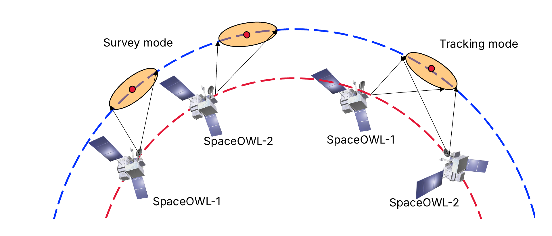
The Korea Space Situational Awareness (K-SSA) Program, funded by the Korea Astronomy and Space Science Institute (KASI), will watch near-Earth space from orbit. KASI will launch two small satellites, SpaceOWL-1 and SpaceOWL-2, each carrying a camera that looks out into space. In this project, York University builds the artificial intelligence that turns their images into reliable information: which objects are in view, and how each one is moving. The project runs from November 2026 to October 2030.
The challenge
Space situational awareness works like a chain. First an object is detected in an image. Then it is tracked across frames. From the track, its orbit is computed, the risk of collision is assessed, and, if needed, a manoeuvre is planned. Our work is the first two links of that chain, and every later step depends on them. A missed detection is a missed warning; a false one is a false alarm.
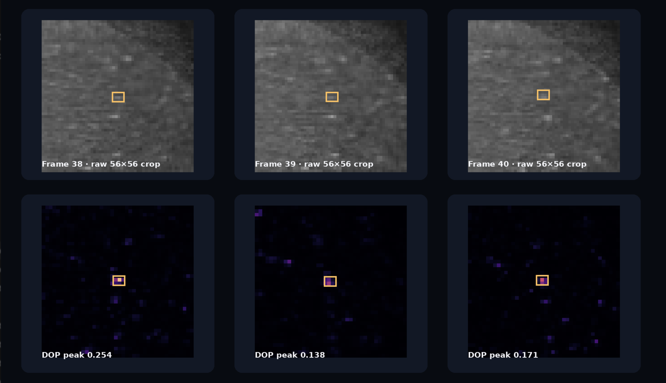
These first links are hard. Seen from orbit, a satellite is often only one to three pixels wide, a faint dot among thousands of stars. Before launch, there are no real SpaceOWL images to learn from. After launch, a satellite can send only a small share of its images to the ground. And the images must be processed quickly, close to real time.
Our approach
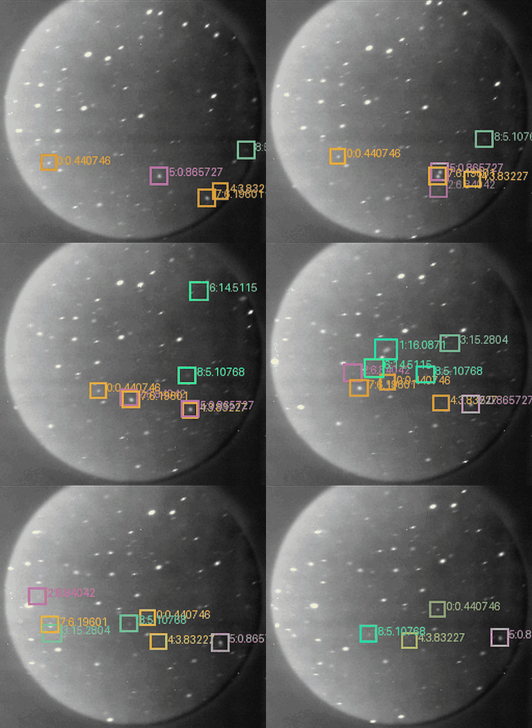
We teach AI to tell objects in orbit apart from stars by watching how they move. Stars drift together across the frame as the camera moves. A satellite or piece of debris follows its own path. Our networks look at several frames at once, so even very faint objects stand out by their motion. A shared network then links each object from frame to frame into a single track, keeps the track going when the object briefly passes behind a bright star, and checks that the path makes physical sense.
Because the AI has to learn before SpaceOWL flies, we build its training data ourselves. A physics-based simulator renders realistic star-tracker images from real star catalogues and satellite orbits, adding sunlight, camera optics and sensor noise. The simulator knows exactly where every object is, so each image comes with perfect labels at no cost. We combine these synthetic images with real images from earlier missions: the DUST benchmark taken by the Fast Auroral Imager on the CASSIOPE satellite, and star-tracker cameras flown to the stratosphere on Canadian Space Agency balloons.
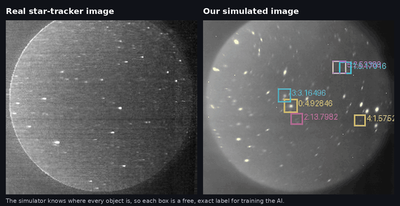
The heart of the project is a closed loop between simulation and reality. Real images make the simulator more realistic. A better simulator trains better models. The models are then tested on real images again. Before launch, this loop runs on data from earlier missions. After launch, it runs on SpaceOWL’s own images.
Build, Fly, Adapt
The project unfolds in three stages. From 2026 to 2028 we build: the simulator, the training data and the detection and tracking models, up to a flight-ready version. In 2029 we fly: the models are frozen, tested inside the ground system and made ready for the launch of SpaceOWL-1. In 2030 we adapt: as the first real images arrive, we recalibrate the simulator and fine-tune the models on a small number of real examples, without losing what they learned before launch. The adapted models then carry over to SpaceOWL-2.
Our early tests on real images taken in orbit are encouraging. Training first on synthetic video helps the network find more faint objects. The hardest cases remain very small objects, slow movers and objects close to bright stars, and these are the focus of the coming years.
Team and partners
The project is led by Prof. Gunho Sohn (ESSE; Director, MOVE), Principal Investigator, who leads the detection and tracking work. Prof. Regina S. K. Lee (ESSE, Space Engineering), Co-Principal Investigator, leads the data and simulation work. Prof. Shweta Mahajan (EECS) leads the adaptation of the models after launch. Prof. Michael C. F. Bazzocchi (ESSE, Space Engineering) brings expertise in orbital mechanics to every part of the project. Postdoctoral fellows, Ph.D. researchers and undergraduate research assistants complete the team.
We work with the Korea Astronomy and Space Science Institute (KASI), which funds the project and owns the mission, and with Hanwha Systems, the system integrator that will run our models in the SpaceOWL ground system. The project builds on more than 15 years of collaboration between York University and KASI under an MOU. It is hosted jointly by MOVE (Mobility Innovation Centre) and CRESS (Centre for Research in Earth and Space Science) at York University.
Related publications
- V. Suthakar, P. Kunalakantha, R. S. K. Lee, G. Sohn. An On-Orbit Star Tracker Benchmark for Resident Space Object Detection and Attitude Estimation. Scientific Data, 2026. doi:10.1038/s41597-026-07736-9
- Y. J. Jeong, V. Suthakar, R. Qashoa, G. Sohn, R. S. K. Lee. OrbitTrack: Advanced RSO Detection and Tracking from Wide Field-of-view On-orbit Images. Advances in Space Research, 76(8), 4387–4400, 2025. doi:10.1016/j.asr.2025.08.006
Funder
Korea Astronomy and Space Science Institute (KASI), Daejeon, Republic of Korea, under the Korea Space Situational Awareness (K-SSA) Program, space-based segment (SpaceOWL).
Project title: Development of AI-Enabled Data Infrastructure on Space-Based RSO Detection & Tracking and Post-Launch Adaptation
Period
November 2026 – October 2030
Join us
We are hiring several postdoctoral fellows, Ph.D. students and undergraduate research assistants. See open positions →
Contact: gsohn@yorku.ca